LANDXPERT

The CAD software for digital planning, construction, and billing

Draw once. Reuse everything.

You create precise plans, visualizations, and quantity takeoffs in a seamless digital process. From design through execution to billing, you reuse the same CAD data—without duplicate entries or unnecessary rework.

LANDXPERT is ideal for anyone who wants to reliably plan, execute, and bill outdoor spaces, landscape projects, and construction projects. The CAD technology is available as a complete solution as well as a specialized add-on for existing AutoCAD versions.

Schedule a free consultation

Your Benefits with LANDXPERT

Draw once. Use it many times.
  • Use your CAD data for design, visualization, quantity takeoff, construction, and billing.
Precise quantities from the very beginning
  • Calculate quantities, areas, volumes, and earthwork volumes directly from the drawing.
Convince Customers More Effectively
  • Make planning easy to understand—with beautiful plans, 3D views, planting diagrams, and visualizations.
Execute more securely
  • Create precise construction drawings, details, elevations, digital terrain models (DTMs), and data for machine control systems.
Faster Billing
  • Document quantities in a traceable manner and create verifiable records for billing purposes.
Working with an Eye Toward the Future
  • Take advantage of interfaces, BIM features, and digital data flows for modern project management.

Features and Highlights

Planning and Visualization

From the first sketch to a compelling presentation

With LANDXPERT, you can turn initial ideas into professional plans. Depending on the project and presentation goals, you can work with simple overhead views, high-quality plan designs, 3D views, or create a foundation for photorealistic visualizations.  

Clients understand what’s planned more quickly. Requests for changes can be easily incorporated and reevaluated. This simplifies coordination, speeds up decision-making, and strengthens your consulting services.

Planting Plan

Plan Plantings Professionally and Present Them Clearly

The planting planning feature in LANDXPERT supports you with intelligent plant objects, comprehensive plant data, and automatic visualizations for different views.

Plants can be displayed as symbols, photos, watercolors, or 3D objects. Flowering times, colors, and seasonal aspects can be clearly visualized. This results in planting plans that are both technically accurate and easy for clients to understand.

With the integrated AI support, you can generate customized care instructions for selected plants. These instructions are based on site and plant information and are inserted directly into the CAD plan as editable text labels. This allows you to create additional value for your customers—in no time at all.

Measurements and Quantity Calculations

Exact Quantities Instead of Estimates

With LANDXPERT, you can calculate areas, lengths, volumes, and earthwork volumes directly from the drawing. The calculated quantities are thus reliably available from the very beginning for bidding, execution, and billing.

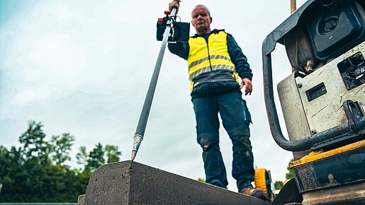
When combined with digital surveying, this creates a seamless process: surveying existing conditions, planning in CAD, calculating quantities, and billing—without media breaks or duplicate data entry.

When used in conjunction with BUSINESS, quantities and masses can be directly linked to the line items in the corresponding bill of quantities. This allows the CAD data to be immediately reused for bidding, cost estimation, and billing, eliminating the need for duplicate data entry.

Construction Site Management

CAD Data for Stakeout, Construction, and Machine Control

LANDXPERT provides the digital foundation for the construction site. Construction drawings, elevations, details, and stakeout data can be reused directly.

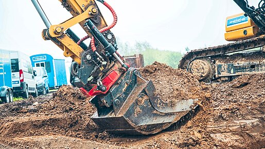
Through interfaces such as LANDXML or DXF, georeferenced planning data can be transferred to excavator and machine control systems. This saves time, increases accuracy, and enables modern work methods on the construction site.

BIM Manager

Using IFC Data in LANDXPERT

With the Dataflor BIM Manager, you can import IFC files into your CAD drawing and use them as a basis for planning, execution, and billing. Both 3D geometries and the included object information are available for this purpose.

This allows you to participate in BIM projects and create a comprehensive 3D model using attribute assignments.

Dynamic Blocks

Smart drawing objects save time and prevent errors

With dynamic blocks, you can use predefined CAD objects that can be quickly customized. Dimensions, variants, views, and sections can be controlled directly within the object.

Instead of redrawing recurring components from scratch, simply adapt smart elements to the specific situation.

Who is LANDXPERT designed for?

Gardening and Landscaping

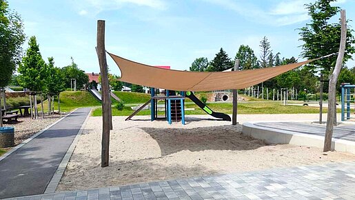
For businesses that want to integrate design, execution, planting plans, measurements, and billing digitally.

Earthwork and Civil Engineering

For companies that work with precise terrain data, machine control, earthwork volume calculations, and verifiable billing.

Image source: © Büro Knoblich GmbH Landscape Architects, https://bk-landschaftsarchitekten.de
Landscape Architecture

For architectural firms that want to integrate high-quality designs, construction drawings, quantity takeoffs, and BIM data into a single CAD workflow.

Municipal Contracting Authorities

For projects where clear plans, quantities, documentation, and interfaces are essential.

LANDXPERT in the Dataflor System

With Dataflor BUSINESS

Quantities from LANDXPERT can be reused in cost estimates, quotes, and invoicing. This creates a seamless process from planning through to the final invoice.

With MEASURE now PRO

Digital measurement and survey data serve as the precise basis for planning, staking out, and billing.

With LANDSKETCH

CAD data and 3D visualization complement each other perfectly when projects need to be presented in a particularly vivid way.

With the Dataflor apps

Plans, information, and project data are also available on mobile devices right where they're needed: on the construction site.

What Makes LANDXPERT Special

High accuracy
  • Quantities, elevations, masses, and stakeout data are generated based on precise CAD data.
Less rework
  • Changes can be incorporated more quickly and have an immediate impact on quantities and documentation.
Modular Introduction
  • LANDXPERT can be customized to meet your needs and expanded step by step.
Seamless Data Flow
  • Design data is not only drawn up, but also reused throughout the entire construction process.
Better Coordination
  • Visualizations and clear plans foster a shared understanding among clients, the team, and project stakeholders.
Verifiable documentation
  • Quantity takeoffs and billing data are derived from the drawing in a traceable manner.

Frequently Asked Questions

Is LANDXPERT only suitable for landscaping?

No. LANDXPERT is suitable for landscaping, landscape architecture, and earthworks and civil engineering. The software supports design, construction planning, quantity takeoff, surveying, BIM, and billing.

Can I also calculate quantities using LANDXPERT?

Yes. Quantities, masses, and earthwork volumes can be calculated directly from the CAD drawing. Changes to the plan can be taken into account, ensuring that the quantities remain traceable and up to date.

Can I use LANDXPERT on a construction site?

Yes. LANDXPERT provides construction drawings, details, elevations, stakeout data, and digital data for machine control. This allows CAD data to be reused directly during construction.

Does LANDXPERT support machine control?

Yes. Planning data can be transferred to excavator and machine control systems via interfaces such as LANDXML or DXF.

Can I use LANDXPERT for billing?

Yes. LANDXPERT supports CAD-based quantity takeoff, earthwork volume calculations, and verifiable documentation. Data can be transferred to accounting software.

Can I combine LANDXPERT with other Dataflor products?

Yes. The integration with BUSINESS is particularly seamless. Quantities and documentation from LANDXPERT can be reused for cost estimates, quotes, and billing. There is also an interface with the LANDSKETCH visualization software.

Can I use LANDXPERT with my existing software?

Yes. LANDXPERT can be integrated into existing processes via interfaces. During a one-on-one consultation, we’ll determine which integration makes the most sense for your current software environment.

Does LANDXPERT support BIM?

Yes. With the BIM Manager, you can use IFC data in LANDXPERT. This allows you to integrate BIM data into planning, construction, and billing.

Can I start small and expand later?

Yes. Dataflor solutions are modular. You can start with the features that are most useful to you right now and expand them step by step later on.

Who will help us with the rollout?

Dataflor supports you with personalized consulting, training, and support—and, if desired, on-site assistance. The goal is to help you get started in a way that fits your team and your processes.

Subscribe to the Dataflor Newsletter

Stay up to date: with the latest topics, new products, events, and tips for your day-to-day digital work.